


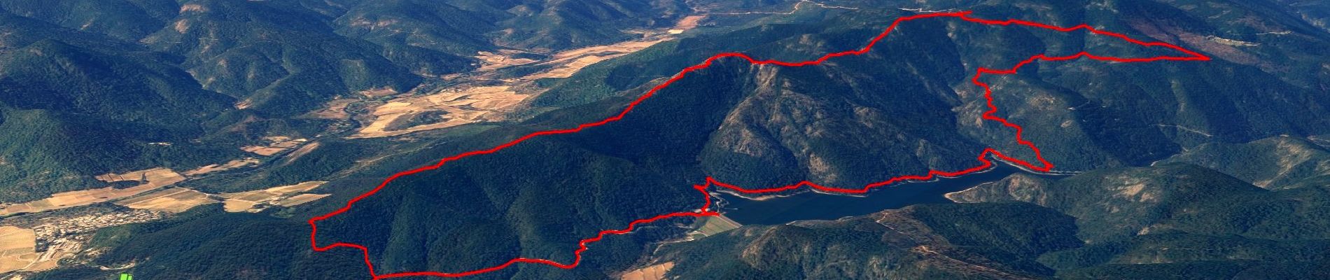
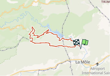
SityTrail - Barrage de la verne - Sommet de l'Argentière par les crêtes des Pradets - Retour par le bord du lac

affinetataille
User GUIDE


6h00
Difficulty : Difficult

FREE GPS app for hiking
 SityTrail
IGN / Geographical institutes
SityTrail Plus
The world is yours!
About
Trail Walking of 16.7 km to be discovered at Provence-Alpes-Côte d'Azur, Var, La Môle. This trail is proposed by affinetataille.
Description
Une seule vraie difficulté, lors de la montée du départ, le passage dans la zone rocheuse en crête. Chemin non balisé mais bien visible et ponctué de nombreux cairns. Le tracé OpenStreetMap est assez fidèle sur cette zone.
!!!!! Se garer avant la barrière; après c'est 135€ (c'est du vécu, la barrière était relevée et je ne l'ai pas vue, je me suis garé juste avant le barrage et bingo...)
Photos


Positioning
Comments